Wasootch Peak

By Joad Clement

Posted on 6/17/2018 6:25 AM
On Friday evening June 15, 2018, Stasys and I decided  to head out to the South summit of Wasootch Peak despite the uncertain weather, with 50% chances of showers in the forecast. The forecast did not lie as half of our trip, mostly during the descent, was completed under a light rain.
The trip allowed us to experience a mixed bag of mountain weather conditions in a short period of 2 hours 45 min car to car: sun, rain, wind gusts, snow flurries, and some excellent views of the changing sky.
I would certainly go back there as an evening outing and reach the North summit, or even venture all the way to nearby Kananaskis Peak.Typical Hiking Trail for the first 600 m of elevation gain

Dark Clouds to the South

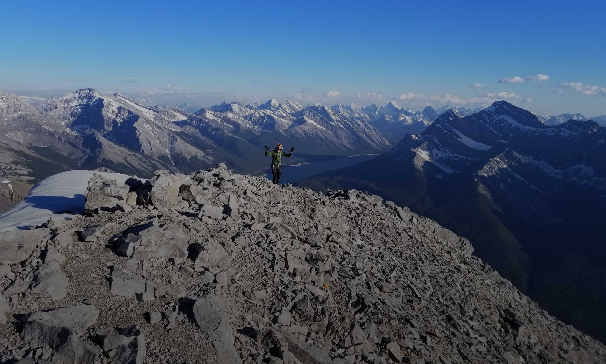
Stasys on the South summit

Kananaskis Peak to the South

Amazingly dark sky once back close to Calgary

END

Mount Roche, Yarrow & Spionkop Ridge

By Geoff Hardy

Posted on 6/10/2018 6:13 PM

It’s a big drive down to Castle so we needed a big day to make the most of it!

We started by biking 4 km along a gas plant road and then stashed our bikes in the trees by a fork in the road. From there we hiked up the mostly dry Spionkop Creek. It was only a few minutes along the creek when I stumbled over a wobbly rock and broke my thumb on a rock. Fortunately we were not going to let that slow us down so we continued on up to Mt Roche (also known as Spread Eagle Mountain).

From the summit of Roche, it was a pretty quick detour down to the outlier known as Mount Yarrow before heading back to Spionkop Ridge. Travel along the ridge had enough colourful rock and variety of terrain to keep us amused. As we neared the summit, the wind went from breezy to blasting. At the summit we decided that due to the stormy looking weather rolling in, we would pass on visiting Loaf Mountain and headed down to the col and out the valley.

There was quite a bit of route-finding on the way down the valley to avoid bush-whacking and various cliffs. After the fun of the ridge traverse, this part seemed really long. Eventually we got back to the bikes, where we were grateful for an easy ride down to the car – we hardly needed to pedal.

Stats: 8km bike, 27km hike, 1975m elevation gain, 10:30 hours

Threepoint Mountain & Mount Rose

By Geoff Hardy

Posted on 6/3/2018 9:00 AM

For our trip up Threepoint Mountain and Mount Rose, we parked at the junction of Powerface Trail and Highway 66 due to construction. From there, it was an 11.5km bike ride in along the Big Elbow trail which is in great shape. Crossing the Elbow River was straight forward and we were soon slogging up to the three points of Threepoint. From the highest summit, we descended the west ridge to reach a break in the cliff bands (thanks to Vern for his trip report) before a gruelling traverse and then regaining of the ridge. After ascending Mt Rose, we followed the west ridge down and then out the very scenic Cougar Creek.

Stats: 23km bike, 16.5km hike, 1760m elevation gain, 10:25 hours