Rainier in the books before storm arrives, plus trip leader takes full body swim and loses pole on approach…
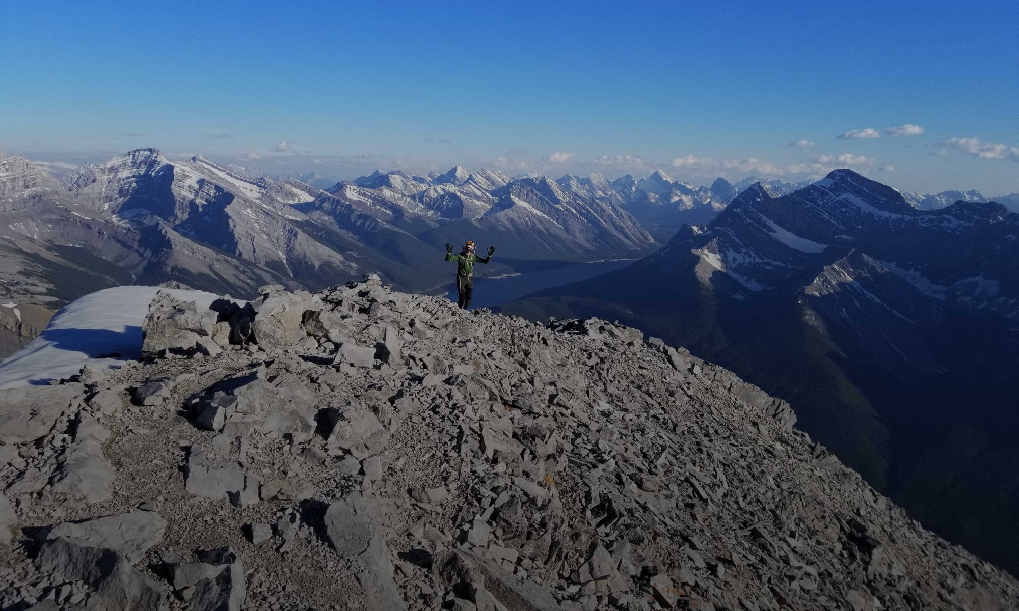
SUCCESS! Despite the many challenges facing us we managed to bag Rainier, Adams and Hood all in excellent conditions.
Some trip highlights include:
• Nailing the weather window on Mt Adams by less than 30min with rain/snow on either side and still getting blue ski on the summit surrounded by clouds
• Skiing your favorite frozen Brassica Oleracea (Broccoli, Cauliflower) off the summits
• Facing the crowded routes on Mt Hood aka Disney Land of the North West
• Enjoying many a fine brew at the end of each ski
• Taking 30minute hot KOA showers and drying out our stuff
• Managing extreme weather – heat wave on Rainier, then torrential rain before a window opened for Mt Adams and then absolute blue bird on Mt Hood
Many thanks to a great team.
The next volcanoes on the list are Baker and Shasta, hopefully a bit earlier to minimize walking. Bring your sunscreen.
• Having the GPS tells us that the crevasse crossing was 30m right but the wands aren’t
• Leaving your SPOT on the summit of Rainier only to remember and spend another 15min getting premium exercise returning to the summit caldera
• High consequence crossing a raging afternoon torrent with overnight pack and ski boots via some creative 5.4 Tree aiding over a tree stump that half extended to the other side
• Carrying skis way more than we ever wanted to
• Losing one participant to a work emergency after Rainier and getting to the airport just in time
• Coordinating 5 participants with 4 cars in both time and space
• Finding places with power, internet and decent food from which to work on the ‘off’ days
• Driving ~ 3300km there and back with ~ 13hrs each way
• Dealing with ornery border guards
• Slipping on a vociferous stream crossing with ski boots with an overnight pack, taking a bath and losing a ski pole, and then drying out completely in the heat
• Jerry rigging an ice axe and ski shovel handle to double as a ski pole (ultra light gear utilization)
• Forgetting your lunch/snack bag for the 2 day attempt on Rainier
forgot a couple:
• Having the GPS tells us that the crevasse crossing was 30m right but the wands aren’t
• Leaving your SPOT on the summit of Rainier only to remember and spend another 15min getting premium exercise returning to the summit caldera
• High consequence crossing a raging afternoon torrent with overnight pack and ski boots via some creative 5.4 Tree aiding over a tree stump that half extended to the other side
• Carrying skis way more than we ever wanted to
• Losing one participant to a work emergency after Rainier and getting to the airport just in time
• Coordinating 5 participants with 4 cars in both time and space
• Finding places with power, internet and decent food from which to work on the ‘off’ days
• Driving ~ 3300km there and back with ~ 13hrs each way
• Dodging the dreaded blue bag only to be assaulted by the intense vapor pressure at Camp Shurman’s outhouse
• Carrying the used & feared blue bag to the summit of Hood and back down again structurally intact
Thanks Robert for the top notch planning and execution of this multi-day multi-summit out of country trip!
Thanks to all other partners on the trip too! We had a great solid and well prepared team which translated into a great experience with a low epicity factor ( I made that word up! Low drama=no epic).
Looking forward to the next big adventure with this fine gang 🙂 – Gen
Thanks again Rob for all the research and planning you put into this trip. It looks like you covered all the highlights of the trip already, except for Shaun going to Oceanside for surfing in between Adams & Hood! – Mike
Rob, A truly memorable trip made so with your careful planning, an outstanding group and some good luck with the weather! The highlight of the year for sure. Thanks for making this happen. – JM
This is definitely a trip worth repeating several times – with multiple lines to be had on each mountain. – Shaun
Stats – values approximate
Ranier
Day 1
1580m vertical
6:50hrs
11km
Day 2
1483m vertical
7:30hrs
7km
7hrs, 18km descent
Adams 2050m vertical
6hrs up
2:50hrs down
Hood 860m vertical (after lift)
3:30hrs
2.6km
1hr, 1615m vertical, 6.2km descent
Original CSMC Trip https://www.meetup.com/Canadian-Scrambling-and-Mountaineering-Company/events/228880636/
Details
Primary target is Rainier 14411ft 4394m according to Wikipedia. The record is 4 hours round trip though weekend warriors come in more like 18hrs up and 1hr down.
The good news is that it snows a LOT on the coastal range. The bad news is that it snows a LOT. Meaning that it is absolutely mandatory we hit a good weather window. So booking a flight in advance is out of the question. And booking a flight 2 days before will cause premature nosebleeds in terms of pricing.
So dates are tentative and you have to be able to shuffle work schedules to meet the appropriate priorities 😉
About You
You also need to be able to wrap your head around 3000 vertical meters without taking your ski boots off! So yes, you need to be fit but not necessarily genetically gifted. Having a masochistic streak helps as does a general mountaineering attitude / memory impairment.
And yes, numerous stops on the 3000m run down are expected. Of course you are comfortable on variable snow: from concrete, concrete sustrugi, breakable crust, perfect corn and slush.
You will also be proficient with crevasse rescue best practices.
MOUNT RAINIER DETAILS
So, the best alternative is to watch the weather like a hawk late May to mid June and spot that magic H over the pacific. Google says we can get there by car in 13:43hrs for 1254 km. So say 14hrs with 4-5 drivers depending on which vehicle drives. Yes, that’s a lot of driving and, Rainier is the prize. So realistically that works out to:
1 long day drive down
1.x long day for Rainier
1 recovery day
1 more modest day for Baker (it’s only 10,000 ft)
1 long day home and crawl under a table at work the next day
Total time: 5 days
Alternative Scenario
Depending on work schedules/timing etc., some of us may bring their laptops with the idea of going down on a Friday and returning a week later on the Sunday. This scenario mitigates the brutal 28hrs of driving and offers additional summit or at least ski potential. Much will depend on who is able to go and who is able to drive / take the time. It also offers the opportunity to stop by REI and Trade Joes.
Keep in mind that people take up to 5 days in the summer to reach the summit so bagging Rainier in 1.x days is pretty sweet and sans the 3000m of knee bashing on the way down.
Great site for all of the Cascades: http://www.skimountaineer.com/CascadeSki/CascadeLargeMap.html(https://www.wildsnow.com/16575/mount-hood-skiing-snowboarding-backcountry/)
Routes
To see what the genetically gifted can do see: http://www.outdoorresearch.com/blog/stories/dorais-brothers-crush-fastest-known-time-on-rainier
We will be taking the Fuhrer Finger route from Paradise parking lot. http://youtu.be/VmX_aOwyhRk
Nisqually chutes video for reference: http://youtu.be/VjdcjxDHUWw
Park logistics can be found here: http://www.nps.gov/mora/planyourvisit/things-to-know-before-you-climb.htm
Weather and roads are found here:
https://www.nps.gov/mora/planyourvisit/weather.htm
http://www.atmos.washington.edu/data/rainier_report.html
http://www.nwac.us/weatherdata/campmuir/now/
Snow Depth
http://data.nwac.us/CLISNO/CLISNO.TXT
NW Avalanche
http://www.nwac.us/weatherdata/paradise/now/
Maps
http://npmaps.com/mount-rainier/ (free)
The above posting is Rainier centric, more details to follow re Baker. The trip is in the planning stages and final details will be forthcoming once we get past the April Rockies peak bagging season.
MOUNT BAKER DETAILS
Mount Baker sports a respectable summit elevation of 3280m (10760ft) and offers up to 2200m vertical from the parking lot. The terrain is relatively modest though there are crevasses which are filled at this time of year.
We will use the standard Easton/Coleman Glacier way aka the tourist route. I’ve personally walked this route at a moderate pace in 15hrs in late summer with lots of crevasse threading. So skiing it on a clear day will be easy in comparison.
Overall description: http://www.skimountaineer.com/CascadeSki/CascadeSki.php?name=Baker
To see what’s possible click on this links:
http://coastmountainskiing.com/mt-baker-north-ridge-fkt/ (we won’t be doing the technical bit)
Consider that it’s even posted as a guided one day ascent (as in ‘how hard can it be’):
http://www.pacificalpineguides.com/skiing/northcascades/mt-baker-one-day-ski-ascent
Then there are:
http://www.tetongravity.com/forums/showthread.php/125628-Mt-Baker-Easton-Glacier-Approach
https://bcmc.ca/m/articles/view/Mt-Baker-Easton-Glacier-Single-Day
http://www.summitpost.org/easton-glacier/155616
Road Conditions
http://www.fs.usda.gov/detailfull/mbs/home/?cid=stelprdb5150500&width=full